AVENZA Maps.
Dave Wade from the Lone Star Hiking Trail Club updated the TBTL maps in 2023, and they are free of charge for personal use. They contain the most information about the trail, and can be downloaded for offline use in the app, or the PDFs can be printed out.

Use Avenza & FREE Maps
- Find Avenza Maps in the App Store
- Install the App & Touch ‘+’ to add a map
- Search ‘TBTL’ in Avenza Store
- Select a free single map or two-map bundle (18.9 MB)
- Show your location as you hike!
- Move from map to map automatically!
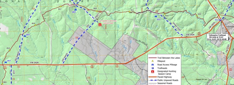
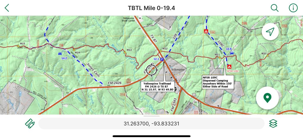
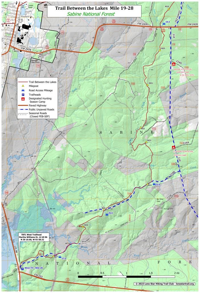
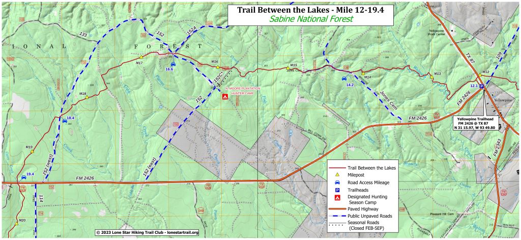
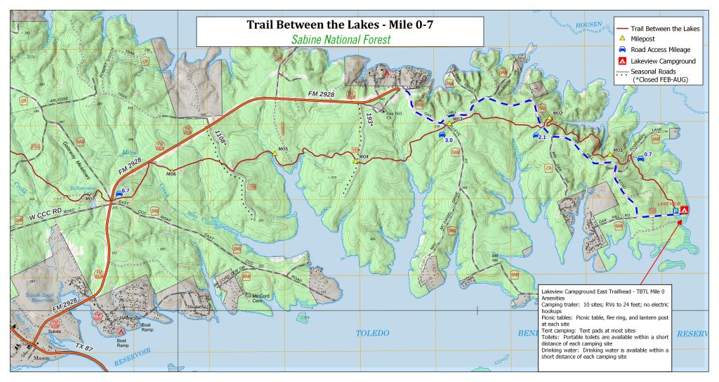
These maps contain hiker-pertinent information, including the trail, mileposts, roads, and creeks. It shows land ownership (including a warning about “Private!” land between miles 26 and 27), parking, and the designated campsites. It also provides the mileage where a road crosses the trail at viable water-caching locations, and red lines across forest road entrances that might be locked.
These maps align with the official trail length of 28 miles, whereas sites like AllTrails, GaiaGPS, and CalTopo identify the trail as 27 miles and place mile markers in locations different from the physical mileposts. The discrepancy is spaced evenly throughout the trail. Google Maps shows the trail, roads, and rivers well, and Trailheads (TH) 1 (east end), TH2 (Yellowpine), and TH3 (west end). Garmin Connect’s map of the TBTL can be synced with compatible watches to assist navigation.

This PDF file of the map used in Avenza covers the trail in four printable pages.

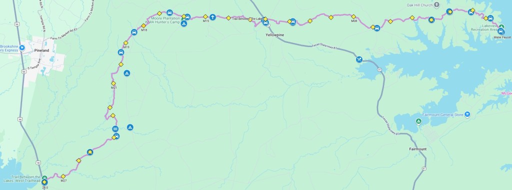
Google Maps
This custom Google Map shows the trail with access points, camp sites, and other points of interest.
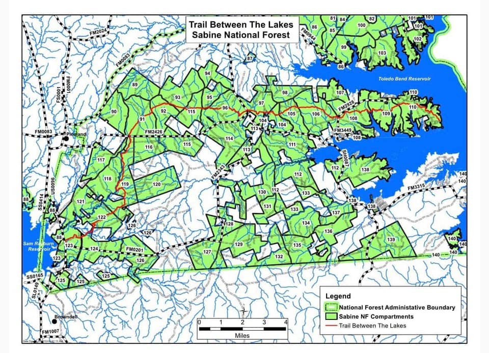
Map of Compartments
The map shows the compartments that the Forest Service uses to identify areas for activities such as logging or controlled burns.

Other Maps
Also of interest to those who are into maps are the free, downloadable, digital Forest Service maps. Interesting maps include their FS Topo maps and their Interactive Forest Visitor maps. Most, if not all, of the information in these maps is included in the Digital Maps on Avenza maps mentioned above. This map (above) shows the Sabine National Forest compartments, which the USFS uses to describe locations of controlled burns and other incidents such as tornado damage or timber sales. A powerful map viewer with access to many layers is at https://www.arcgis.com/apps/webappviewer/index.html?id=a6a32f0501754fdc8932b1c0090a1d83. You can pick through many layers.
This site’s Planning page provides more information about controlled burns here.
GPX Files
This GPX file can be downloaded and imported into mapping software.
