East Texas has hot and humid summers and mild winters. It is known for storms that can bring high winds, heavy rains, and hard freezes. The fall/winter/spring are generally considered the best seasons for hiking. Spring brings beautiful wildflowers.
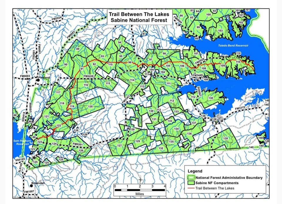
When conditions are favorable, the forest service might conduct controlled burns of the forest. Such burns do not always have a preplanned schedule and can disrupt hikes. See more information from the TBTL Facebook group, or check the USFS National Forests and Grasslands in Texas FB page. This map of the Sabine National Forest compartments can help identify the location of any planned controlled burns.
Texas storms are life-threatening. Strong winds blow down trees. Heavy rain causes localized flooding and creeks to top their banks. Fortunately, the creek levels decrease rapidly after heavy rains and are likely safe after 12 hours.
Trail Conditions
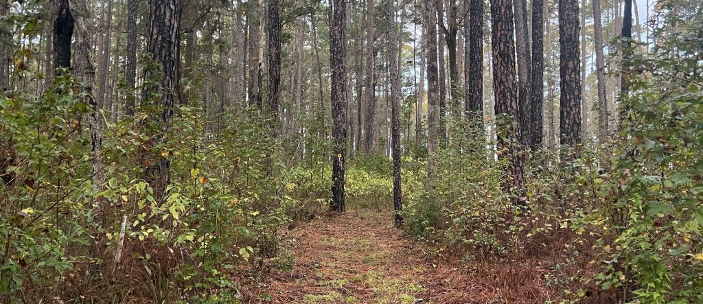
The condition of the trail varies depending on the season and the maintenance status. Each year, volunteer crews clear all downed trees on the trail and mow its complete length. However, the vegetation grows back aggressively, especially over the summer when, in some sections, it erases any sign of mowing in six months. Storms unpredictably blow down trees. Such changes in the trail makes repeat visits all the more interesting. Reach out to the TBTL Facebook Group for up-to-date info, or ask via this website.
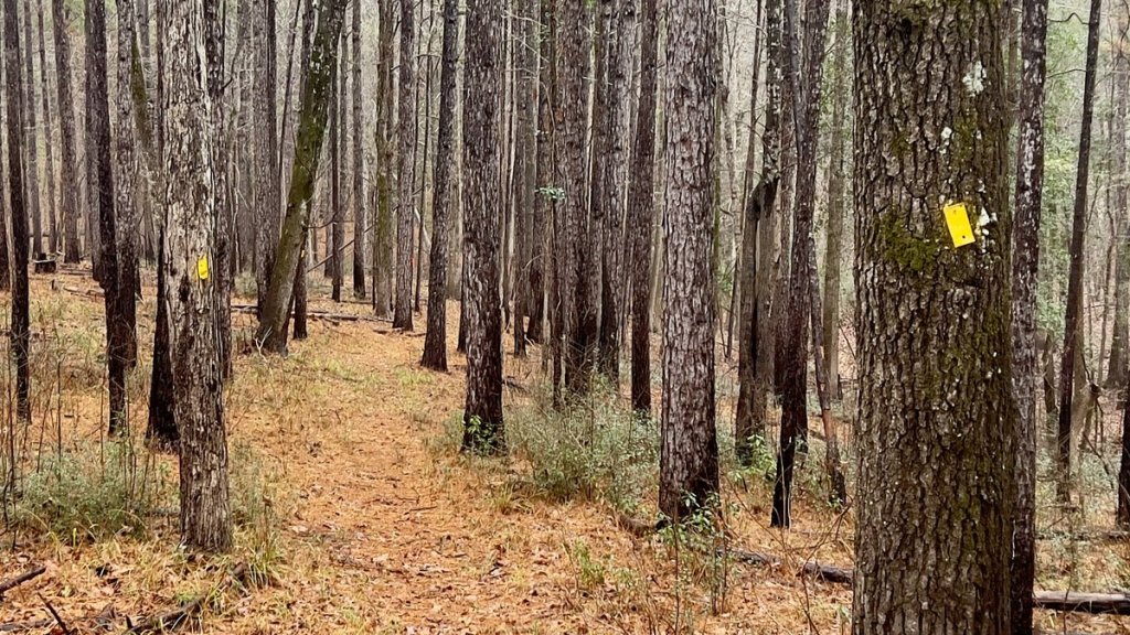
An example of a recently-mowed section of trail.
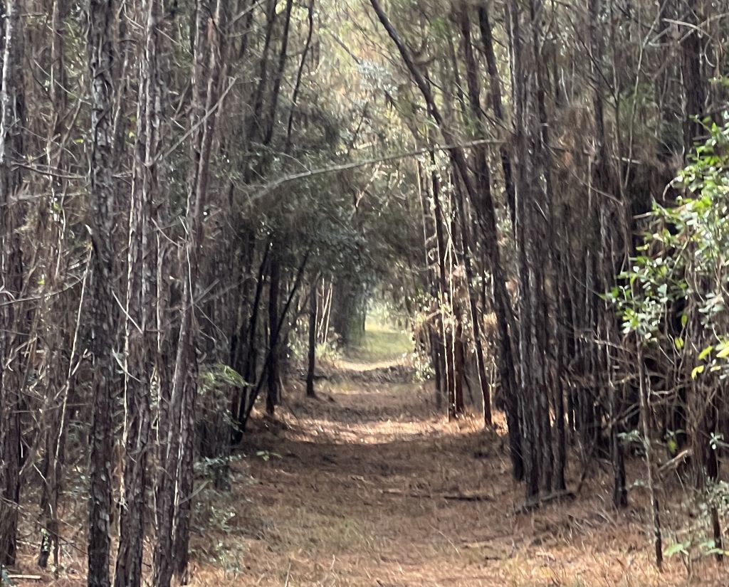
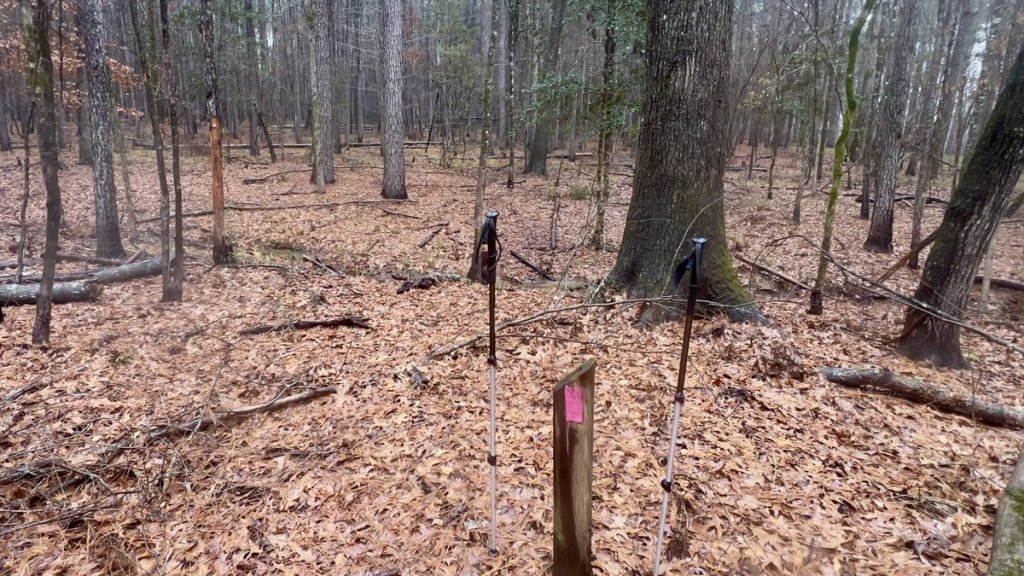
An example of where the forest has reclaimed the trail. Yes, the trail goes that way, and this section was mowed six months ago. Following a GPX route is advised!
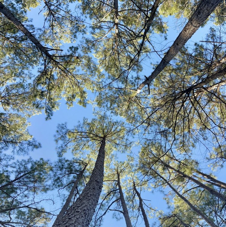
In some sections, the forest’s canopy prevents aggressive undergrowth.In some sections, the trail is a tunnel with a pine-needle bed.
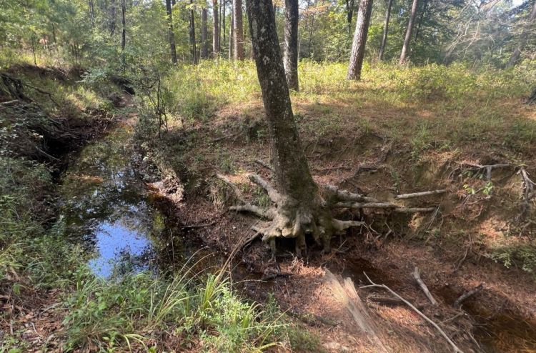
The multiple creek crossings add variety and challenge. While they are throughout the trail, there is a greater number on the east side, which has double the elevation change compared to the west. Creek sides can be steep, and this should not be described as a flat trail! Except during or immediately after heavy rains, the creeks are safe to cross, with Little Creek likely being the wettest (see more below).
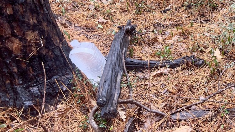
Even though Little Creek was dry for this photo, the banks are still very steep.
A dry Walnut Creek has steep banks.Be careful not to dismiss the elevation change along the trail. While there is a small difference between the minimum and maximum height, the trail goes up and down a lot, especially in the eastern half.
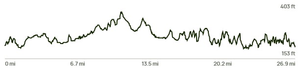
Controlled Burns
Also known as prescribed burns, these events are carried out by the USFS. Their Controlled Burns website provides background information and explains, “Reducing pine litter, dead branches and downed logs promotes a healthy forest.” They do not have a detailed preplanned schedule as they are subject to weather conditions. Information on imminent burns that impact the TBTL will be shared as best as possible in the TBTL Facebook group, or can be worked out below.
This “Southern Region Prescribed Burn Accomplishment Tracker” shows the prescribed burn plan for the Southern USA, with the link zoomed into the TBTL area. The picture shows the map from April 2025. To show the trail on the online map, you add the “National Forest Trails (USFS)” map layer.
This image shows an EXAMPLE of the controlled burn planning tracker and is NOT CURRENT. Check the current plan here.
This trail wasn’t burned after a controlled burn!
Controlled burns add uncertainty to hike planning, similar to weather. However, walking along the trail immediately after a controlled burn, perhaps when some wood is still smoldering, is a fun and insightful experience!
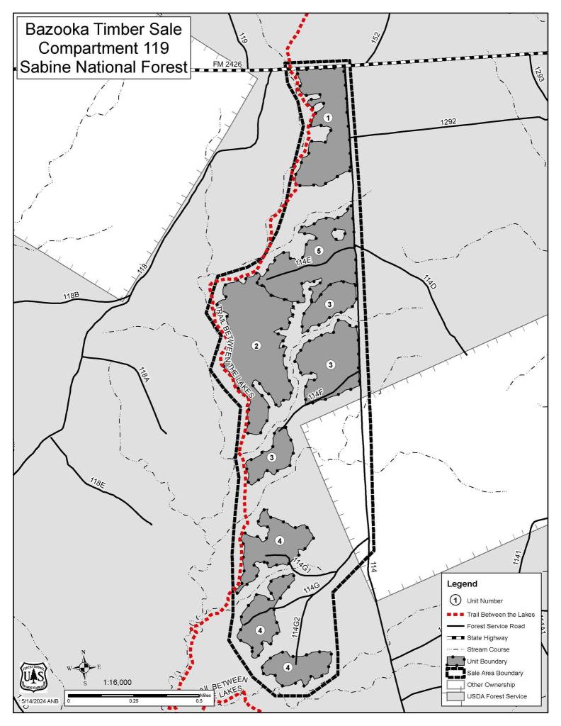
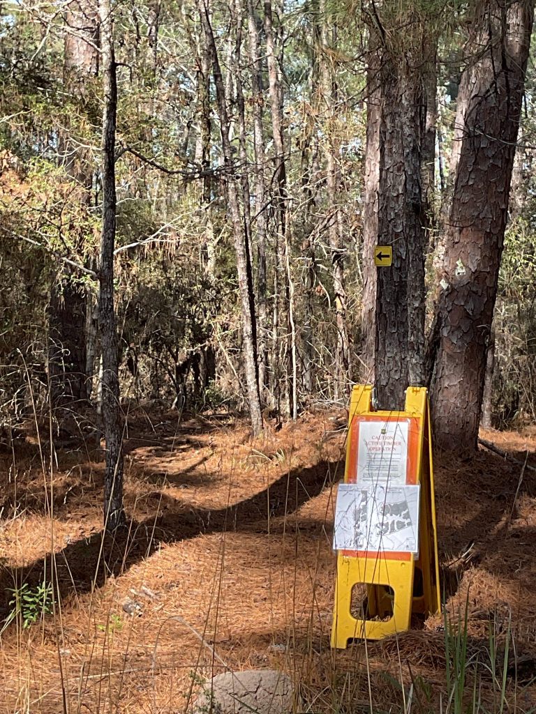
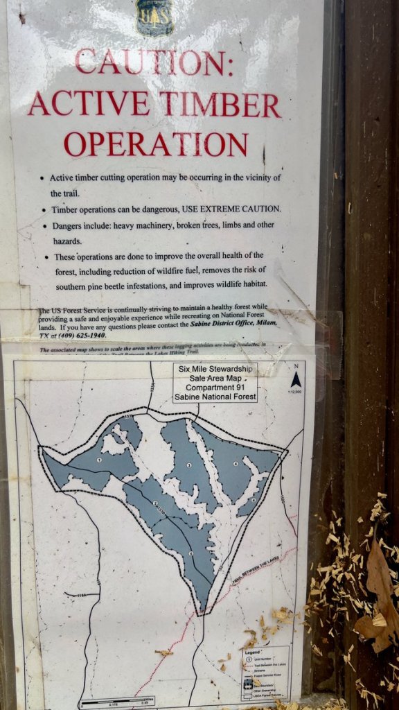
Logging Operations
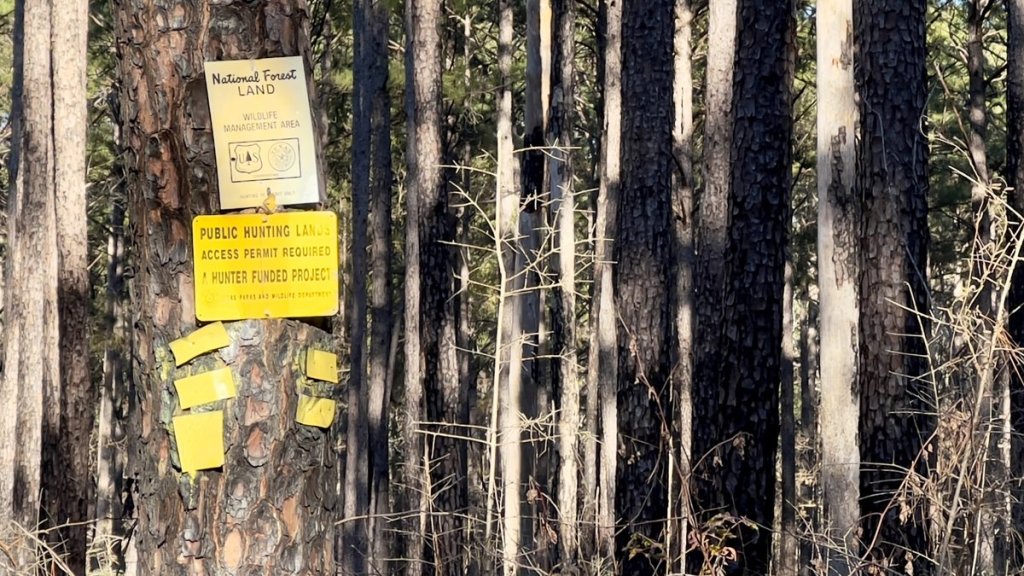
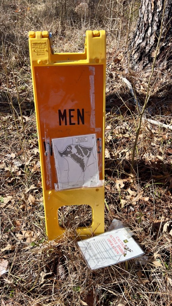
Periodically, there are logging operations near the trail. The forestry service aims to leave the trail intact, but the logging might come close. When such things occur, they post information on their Facebook page and at trail heads.
In January 2026, they posted the notice below. This is in the area of the trail from FM2426 (mile 19.4) south to Little Creek (mile 23.4), but it should not impact the trail.
Active logging operations are currently taking place in the Doublemint and Bazooka timber sales.
While the units being logged are not on the trail itself, they are close enough that we wanted to keep everyone informed for safety and awareness. You may see equipment, hear machinery, or notice increased truck traffic in the area.
Information has been posted on kiosks off State Highway 96, and on trail barricades as you get closer to the actual work areas.
Please stay alert and follow all posted signs. We appreciate your cooperation while this important forest management work is underway in this area.
Permits and Fees
Permits are not required for either hiking or camping on the trail.
There are no fees for hiking or camping on the trail.
Parking
Ample parking is available at the three trailheads: TH1 (east end), TH2 (Yellowpine), and TH3 (west end). Each site has space for a few cars. There is little traffic in these areas, and they are generally considered safe, but precautions remain wise. The parking at the east end is within the Lakeview Recreation area, where a day-use fee applies, and there is a pit toilet and water faucet.
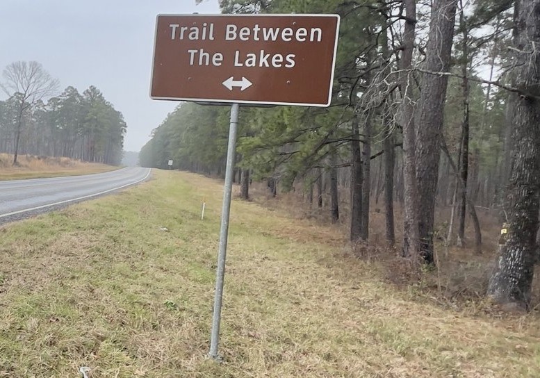
Parking at other points where the trail crosses a road is possible. You have to make your own judgement. Streetview on Google Trails might help you plan this. The red line across the road on Avenza maps suggests the road has a locked gate, while the blue-and-white roads indicate likely accessibility.
Exercise caution when driving off the main roads. Hikers have got their vehicle stuck when pulling off the hard road to drop a water cache, or at the end of a forest road when doing trail maintenance. If this happens on a main road, it is likely a friendly local will stop and pull you out. If you are remote, Hatch’s Towing and Recovery in Pineland has worked well. Ask for Dustin, and he will remember his previous adventure with a TBTL maintenance crew!
Transport
The trail is in a remote area outside the coverage of services like Uber or Lyft.
To contact potential shuttlers, check this site’s Contact page.
In the Six Mile area on Highway 87 (about 1.5 miles south of where the trail crosses roads at “five points” at mile 6.8), there is a Family Dollar, Carlson’s Marine, and the Sportsman’s Cafe (recommended by trail users).
If you are really hungry, perhaps after a thru-hike with insufficient food, the Cedar Tree Restaurant in Jasper has a very tasty and reasonably priced all-you-can-eat buffet.
Accommodation
There are several national hotel brands in Jasper, about 20 miles south of Trailhead 3.
Guided Hikes
Group hikes are held periodically and announced on the TBTL Facebook Group page.
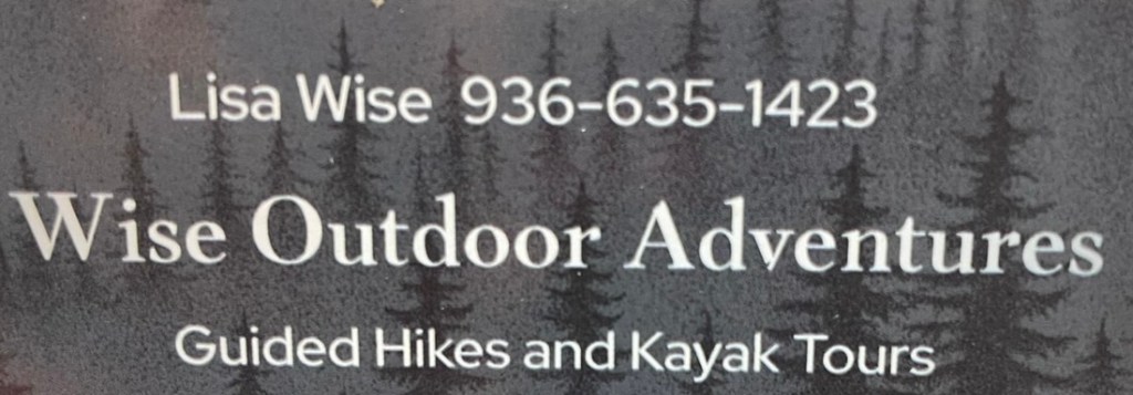
Lisa Wise of Wise Outdoor Adventures offers guided hikes on the trail. Contact Lisa at 936-635-1423 or at lisagwise05@gmail.com.
Camping
Outside of hunting season, camping is permitted in USFS property along the trail (which is essentially the whole trail) except near trailheads. There is no shortage of trees, so the trail is well-suited to hammock hangers. Most thru-hikers find a convenient location anywhere in the woods. There are no “unofficial” sites, so any campsite should be left in the condition it was found. Campfires are discouraged due to the risk of forest fire. There aren’t any rocks to build a fire ring with. Check for burn bans at this TAMU site and follow all Leave No Trace principles, including packing out food scraps and used toilet paper.
During deer-hunting season (Late September to January), a USFS Designated Camping policy restricts camping to the Lakeview Campground or the four established Hunter Camps (more details below). These camps are also suitable for car camping, which is a great way to experience overnighting in the forest without backpacking.
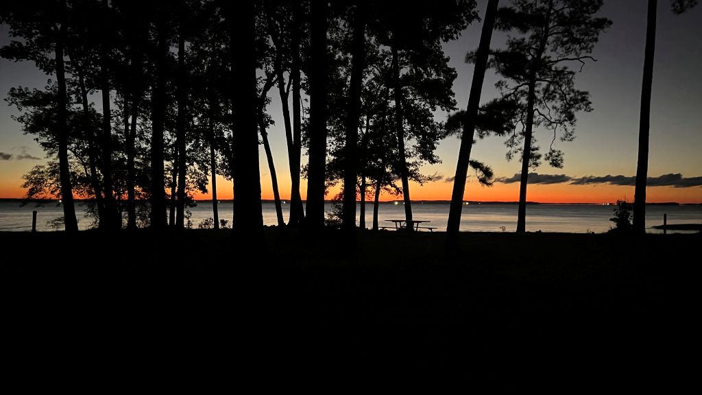
The Sabine River Authority of Texas maintains and operates the Lakeview Campground on Toledo Bend Reservoir at the eastern end of the trail. It has ten sites with fire rings and support tents and RVs. There are no hookups, but there is a drinking water faucet (by site 8), pit toilets, trash cans, and a fee of $3 a night. It’s a beautiful site with a view of Louisiana and a breeze coming off the water.
One of the waterfront sites at Lakeview Campground
Lakeview has beautiful views across the water.
There is designated camping along Forest Road 109C, which has easy access to the trail around mile 10.9. There is plenty of space at the end of the road (also known as Lickety Split Trail!) as well as cleared sites along the road. There are no facilities, and some locations have improvised fire rings.
The N. Moore Plantation Hunter Camp is on Forest Road 152, north of FM2426. There is easy access to the trail around mile 15.8, where you find the remains of an old bridge over Fish Creek.
The Moore Plantation Hunter Camp is located just south of the junction between Forest Road 114 and 114D. This is a very large site. There is a forest road with a locked gate that leads towards the trail at about mile 20.5. It is approximately 1/2 mile from the trail to the camp, with a short off-trail section to get from the road to the trail. Alternatively, you can leave the trail at MP21 and follow the forest road.
The S. Moore Plantation Hunter Camp is located off Forest Road 114 on the road labelled 1296 on the map (a little south of where the camp icon is on Avenza). This is another large site, and the Forest Service Interactive Visitor Map shows that road 1296 leads to the trail. There is no evidence of a forest road crossing the trail as per the map, but an old road crosses further south, closer to Little Creek.
Insect and Animal Precautions.
The trail is prone to mosquitoes, ticks, and chiggers, especially in warmer months. A winter hike might not see any of these. Pre-treating clothes with Permethrin is effective. Deet-based insect repellants and Picaridin are effective. A headnet is a cheap, lightweight barrier against mosquitoes.
During the warmer months, spiders weave webs across the trail. Read “The Spider Experience.” The spiders are generally considered harmless. However, walking into a web across the trail at head height can be distressing. A proven solution is following a taller hiking partner. Other solutions include waving your hiking pole in front of you, or wearing a head net, which is also a wonderful fashion accessory.
Campers should store food appropriately to avoid animals finding it. How this should be done is open to debate. In Karen Somers’s guide to the Lone Star Hiking Trail, she writes, “In East Texas, bears, jaguars, cougars, and wolves were hunted to extinction. Coyotes and bobcats are the most numerous large predators in the East Texas woods today; both are extremely timid and will not bother humans. Raccoons are probably the animal most likely to invade hikers’ camps in their nightly hunt for food. Hang food in trees away from tree trunks to keep it out of their reach.” However, many campers who frequent the TBTL sleep with their food in their tent and do not report any issues.
River Water Levels
Except during very heavy rains and within hours of it stopping, the TBTL does not have dangerous river crossings (compared to the LSHT’s San Jacinto East Fork at mile 71 or the Little Missouri in the Winding Stairs section of the Eagle Rock Loop).
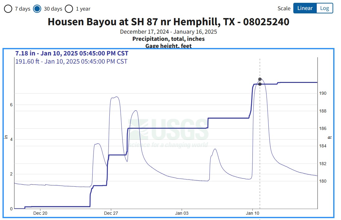
The nearest water gauge is on Housen Bayou at SH87 near Hemphill. This is a good estimate for localized rainfall. However, TBTL creek levels rise and drop faster than Housen Bayou during and after rains. Just before this hike in January 2025, Little Creek (mile 23.5) rose ten feet and burst its banks after two inches of overnight rain, but was just knee-deep twelve hours later. Little Creek and Walnut Creek (mile 13.4) are the largest creeks on the trail. Reports suggest that Little Creek was knee-deep when this gauge was 181ft, and able to be crossed dry when this gauge was at 178ft.
Water Potability and Caching
Due to historical oil and gas drilling, the forest service recommends against drinking water from the trail, even filtered, due to dissolved heavy metals. It might be fine in an emergency, and water caching is easy. This Texas Railroad Commission map shows the location of historical wells, though there is no evidence of these wells when hiking the trail.
Map of historical wells along the TBTL from the Texas Railroad Commission.
There is a water faucet in the Lakeview Campground. Day-use fees help cover its cost.
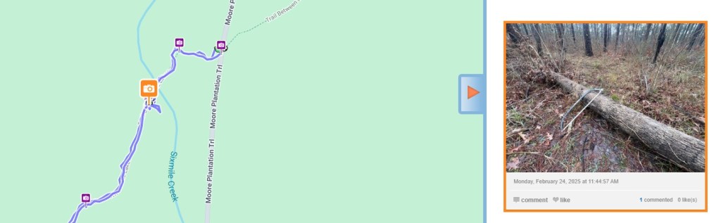
Caching water is recommended and is easy. The Avenza maps label where the trail crosses open roads with a car and the trail’s mile marker. The following locations are suggested: – 0.0, eastern terminus. There is a drinking water faucet in the campground, the only one on the trail. – 6.7, “five points.” There is parking on Gateway Meadows to the northwest of the junction. – 10.9, which is also designated camping during hunting season. – 12.1, by trailhead 2 with plenty of parking. – 14.2, or near the cemetery at 14.8. The road beyond the cemetery, down to 14.9, is pretty rough. – near 15.8, the hunter camp is about 1/4 mile off the trail – 16.6, with parking at the junction – 18.4, with viable parking on the verge – 19.4 on FM 2426, but the verge can be soft – 23.9 or 25.0, off a quiet forest road. – 28.1, western terminus with plenty of parking It is recommended to use screw-top gallon water containers. Label them with your name and expected pickup date, and hide them to prevent someone else from grabbing them. Take the empty bottle with you on the hike – it is light and collapses small. If you are unable to complete your hike and miss a cache, please return to pick it up. If you have had to abandon the hike and a cache due to an emergency and were unable to pick it up, please post a note on the Facebook group so someone can pick it up for you.
A water cache near Mile 6.7, ‘Five Points.” It was labelled.
A water cache near TH2 at Mile 12.1.
On Trail
The trail’s elevation ranges from 181ft at Toledo Bend Reservoir and 387ft around mile 16.8. However, there are many creek crossings, and some gullies are deep with steep sides. Hiking poles help climb these banks.
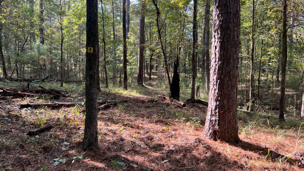
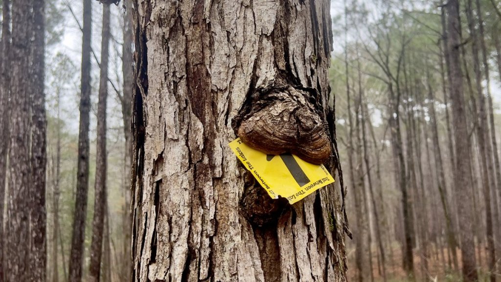
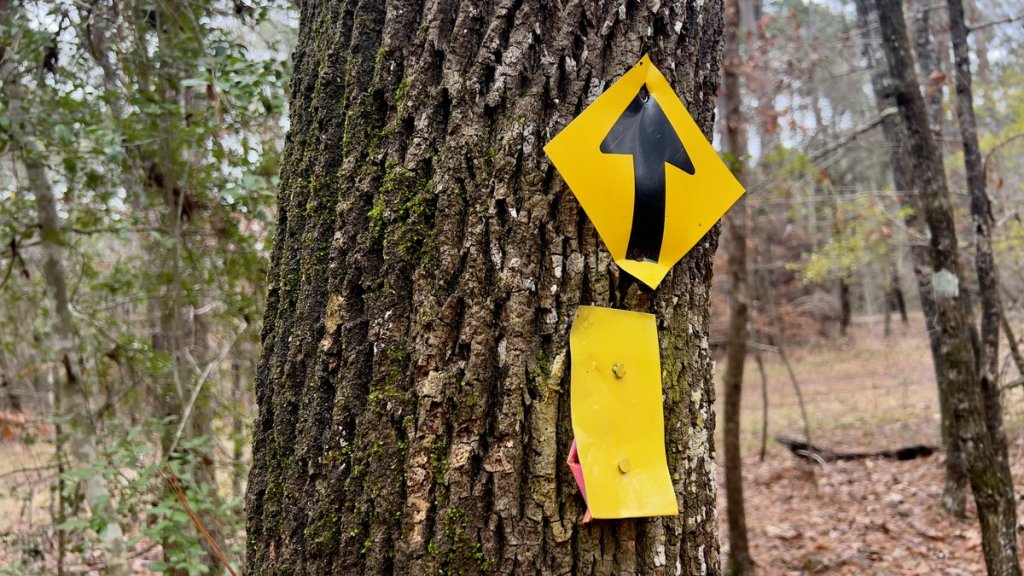
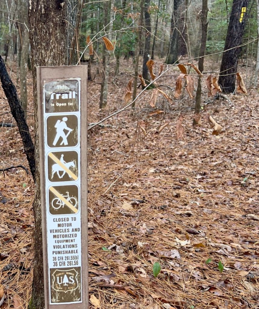
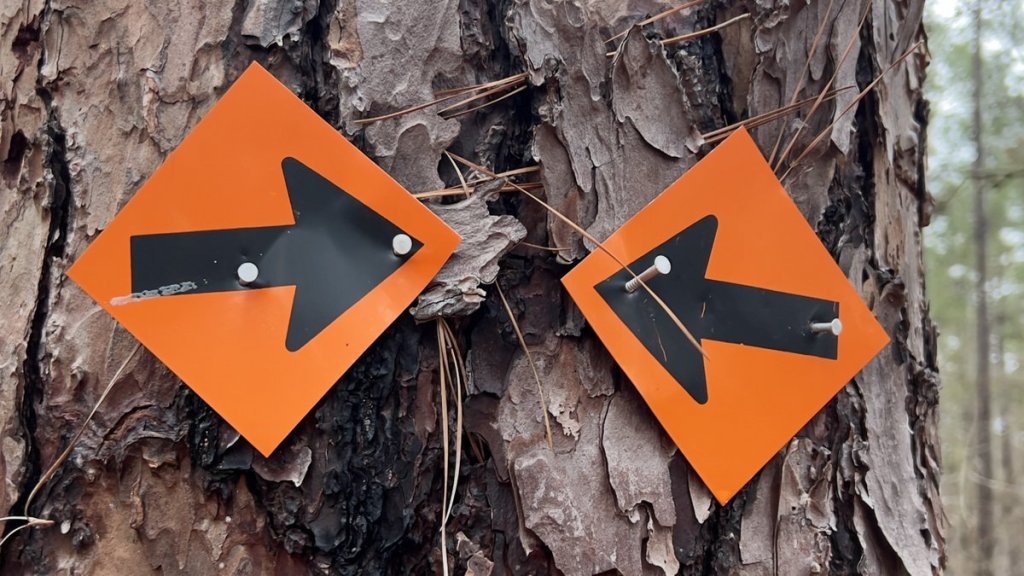
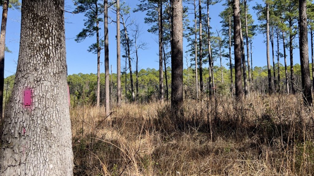
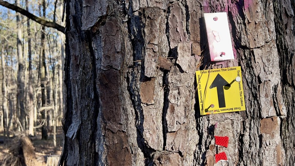
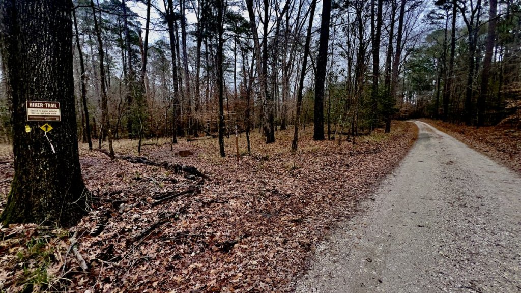
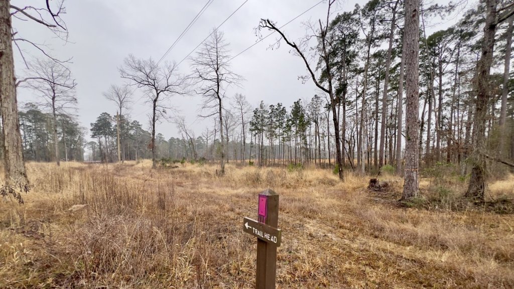
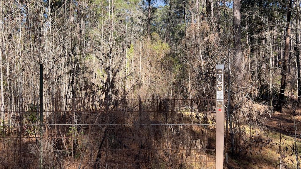
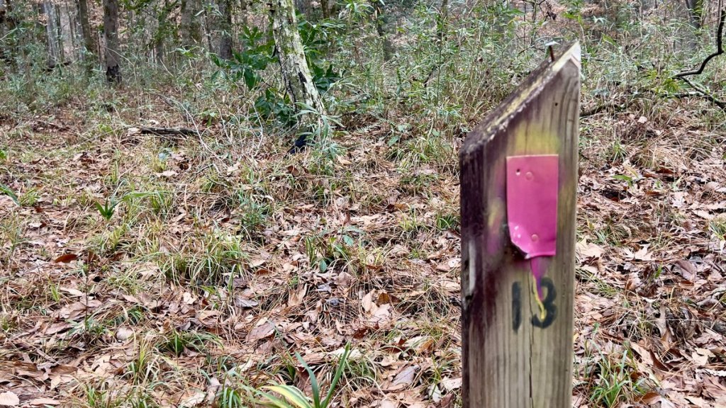
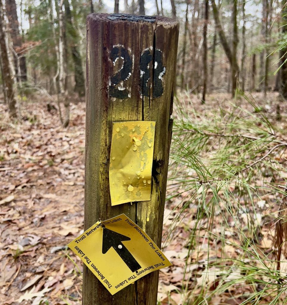
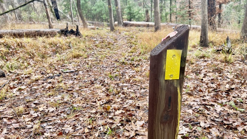
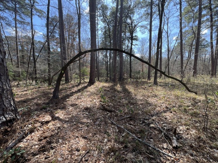
Various metal trail markers nailed onto trees identify the trail. There isn’t another hiking trail in the region, so these metal markers indicate the TBTL. Ribbons are used by multiple forest users and may mark the trail or something else. There are seasons when undergrowth or blowdowns make navigation at some points on the trail less obvious. If you are unable to see the next trail marker, look for evidence of trail maintenance (sawn logs) or previous hikers walking the trail. Look backwards to see what direction the trail markers suggest hikers going in the other direction would be coming from. If all else fails, use your previously downloaded digital map. It would be very difficult to navigate some sections of the trail in the dark. Hikers are most likely to miss the sign when a trail leaves a forest road. So, when you are walking along a forest road, keep your eyes peeled for a trail marker!
Wooden posts with a number on them mark each mile. Their locations are labelled on the Avenza and PDF maps.
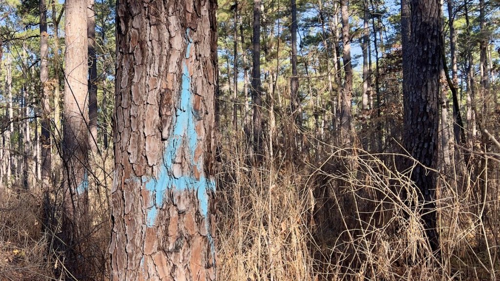
There is hunter-related signage and markings, especially on the western half of the trail. This includes blue, white, or orange paint on trees. Generally, it is not confusing for trail users.
On rare occasions, there might be forestry operations near the trail. Signs will warn you of such operations. The signs might remain in place when operations are not active.
Any hiker can do their bit by picking up trash or moving small limbs off the trail. Sharing a photo and location of obstacles (screenshot of map showing location) helps the maintenance volunteers. For an insight into how regular hikers can help with maintenance, check out Jetgirl Hikes’s 3-minute YouTube video, “Trail Maintenance: Giving Back to the Trails We Love.“
While you will get a cellphone signal in most parts of the trail, there are some dead spots. The dense canopy can be an issue for satellite devices.
If you are interested in volunteering to help maintain the trail, please reach out to the TBTL Facebook Group.
Crossing Little Creek
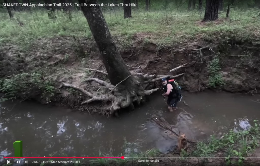
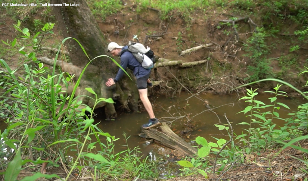
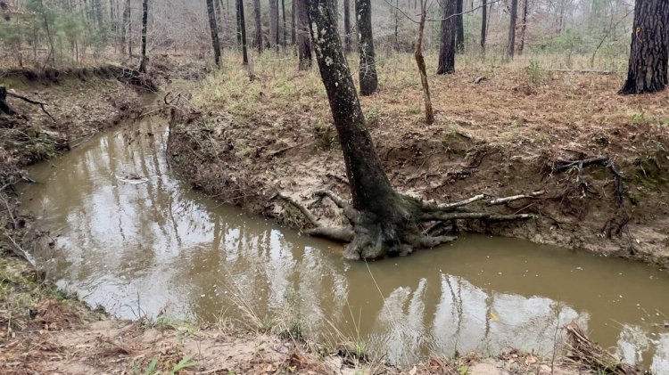
The largest river crossing on the trail is Little Creek at mile 23.5. The steep banks make it difficult to confirm the water depth, which greatly discourages hikers from crossing it. While the water level rises quickly during heavy rain, it also falls quickly when the rain stops. Brent and Melissa McCoy’s YouTube video shows them crossing the river in early April 2025, a couple of days after heavy rain with knee-deep water. However, less than a month later, this video shows Burrito by Nature staying dry while crossing. Except during or immediately after rain, this is the only crossing where the water is likely to come over the top of shoes/boots, except during droughts, and you might consider water shoes. While the rest of the trail has wet sections and multiple creek crossings, you should be able to find a way without submerging a whole shoe.
Knee-deep water in Little Creek, 2-3 days after about 3 inches of rain.
At the end of the same month as the knee-deep water above, a dry crossing was possible.
The same location as above, but 12 hours after 2 inches of rain. Looking at the tree roots, the water appears to be about a foot deeper. Using these pictures, the water level with respect to the tree roots can be used as a local water gauge.
The same location as above, but during a drought in October 2025. The picture shows a log directly below the tree, which makes the water shallower when it is underwater, but you can’t see it when it is underwater!
Alternative crossings over Little Creek might be possible, but they tend to change depending on recent floods. This picture shows easier access down the bank about 100 yards downstream, with a fallen tree that might help the crossing. A nearby tree on the south side has a blue ring, and blue-and-white tape might mark it. There are also reports of logs over the creek upstream of the trail.
If you are hiking northward and you leave the trail to cross the creek, this distinctive tree serves as a marker to help guide you back onto the trail.
Thru Hiking
Thru-hiking the TBTL is a wild experience rarely found in this region. On trail, you will forget that you are so close to roads. You will likely see no one else during a hike.
As the trail is a point-to-point, you will require transport between one end of the trail to the other, unless you yoyo. This website’s Contact Page lists some people who will shuttle here. If those contacts are unavailable, you might be able to find someone in the TBTL Facebook Group. It is best to reach out at least a week before your hike. These people have trail and local knowledge and can help identify suitable water caching locations. Shuttle such that your car is parked at the END of your hike, eliminating the variability of hiking time and availability of the shuttler.
If planning a thru-hike, there is little to choose between which direction you take. People have personal preferences, and a question to the Facebook Group will get responses.
Consider doing a yo-yo hike, where you walk all the way along the trail and back again. The trail’s variety makes the return journey quite different from the outward one! The 56 miles is a rarely-found distance and negates the need for a shuttle. Parking your vehicle at the Yellowpine trailhead acts as a resupply point halfway through your hike.


